




New Utility Software Powers Faster, More Reliable Service in Petersburg
In Brief
ArcGIS Solutions: Preserving knowledge. Powering the future.
In Petersburg, Alaska, outdated paper maps and CAD files—often missing key spatial data or showing incorrect utility locations—made electric, water, and sewer assets difficult to locate and maintain.
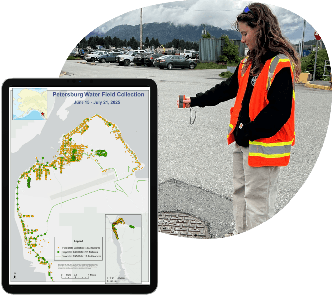
Resource Data and Petersburg staff updated and corrected location and attribute data by mapping thousands of assets into industry standard data models. This formed the foundation for Petersburg’s first complete digital utility system, built with Esri’s ArcGIS Solutions and efficient mobile tools.
Crews can now quickly locate infrastructure, plan maintenance with confidence, and preserve institutional knowledge for future utility network management.
Key Takeaways
From paper to power. Reliable GIS for every season.
-
Centralized GIS ensures reliable records year-round
A modernized system replaces outdated paper maps and CAD files, giving Petersburg accurate utility information for every season.
-
Integrated tools and comprehensive field data collection
Three ArcGIS Solutions were deployed and configured, loaded with CAD data, and enhanced with over 37,000 mapped features collected in just 160 hours on site.
-
Quicker, more precise service response
GPS-enabled maps guide crews directly to assets, even in snow or when buried, reducing downtime and improving reliability.
-
Live operational maps turn data into action
Interactive maps and dashboards transform complex data into clear visuals, making it easy to track progress, spot trends, and prioritize work, while field updates sync instantly with the office.
-
Fast, prebuilt, affordable tools customized for Petersburg
Esri’s ArcGIS Solutions and ArcGIS Online provided a ready-made framework that was deployed quickly, then tailored to Petersburg’s needs for a system built without the expense of starting from scratch.
-
Foundation ready for advanced capabilities
Petersburg’s GIS is built to support future enhancements like Esri’s Utility Network for greater control, smarter planning, and long-term infrastructure management.

Our Client
Petersburg Borough
Petersburg is a remote island community in Southeast Alaska, located on the north end of Mitkof Island in the heart of the Inside Passage. Surrounded by dense temperate rainforest and rugged coastline, it lies roughly 120 miles south of Juneau, the nearest regional hub and Alaska’s capital. It is only reachable by ferry or aircraft.
The Borough oversees electric, water, and sewer systems that keep the community running year-round. Serving 2,500 electric and 1,200 water and sewer customers across 15 square miles, these essential services are central to Petersburg’s ability to support its residents and local businesses.
Challenges
Outdated maps put critical knowledge at risk
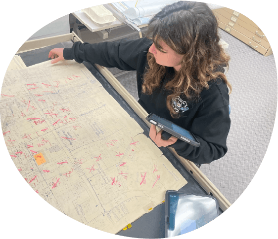
Reliable utility records are vital to keep water, power, and sewer services running. But Petersburg’s most up-to-date digital record was a CAD file that couldn’t be exported to GIS and available paper maps were outdated, some dating as far back as the 1980s.
Petersburg’s location and climate made these data gaps even more costly. Snow and gravel roads often hid manholes, valves, and other buried assets, forcing crews to rely on guesswork and memory. With only one staff member experienced in GIS, there was also little capacity to correct records or modernize systems.
Without a centralized, accurate digital record, Peterburg faced continued inefficiencies, costly delays in locating infrastructure, and higher operational expenses. It also risked falling further behind in adopting advanced GIS capabilities, limiting long-term infrastructure upgrades and increasing the chance of service disruptions.
The Solution
A reliable, easy-to-use utility inventory
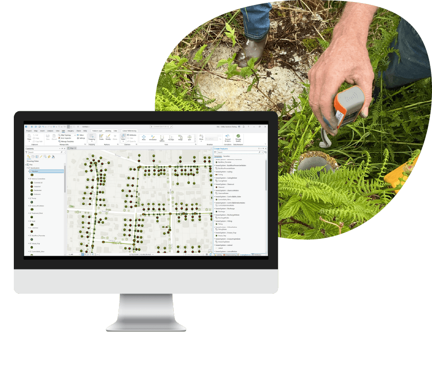
Petersburg’s first complete digital utility system was built by combining modern GIS tools with on-the-ground data collection. Three prebuilt Esri ArcGIS Solutions (Electric Distribution Data Management, Water Distribution Data Management, and Sewer Data Management) were deployed as the foundation, instantly providing dashboards, web maps, and standardized data models. These were then customized with key fields crews rely on, such as equipment type, make, and installation date.
Historic paper maps, aerial imagery, and AutoCAD files were reviewed and corrected to recover what could be used, while outdated entries were removed. Each asset was tagged by its source so staff can easily see whether information came from high-accuracy GPS collection or legacy records.
Resource Data GIS specialists were on the ground for two weeks in Petersburg, working side-by-side with local crews to map thousands of assets, including transformers, fire hydrants, and manholes. This ensured accuracy while also giving Borough staff hands-on training with the new tools. Using mobile iPads running ArcGIS Field Maps paired with Bad Elf GNSS receivers, the team was able to pinpoint assets within just a few meters.

It was one of the most rewarding jobs I’ve ever done. Watching people who had used paper maps their whole lives actually smile when talking about GIS was incredible.
Evalina Macejka, GIS Programmer, Resource Data
Features
Efficient data and software for lasting utility management
-
One trusted source for every record
Legacy maps and files were combined into Esri’s ArcGIS Online (AGOL) system, corrected for errors, and tagged by source. The system also lays the groundwork to connect with maintenance tools or new datasets in the future.
-
GPS apps for precise field mapping
ArcGIS Field Maps with Bad Elf GNSS receivers guide crews, prompt for asset details, and capture coordinates that improve location accuracy.
-
Real-time sync between the field and office
With automatic syncing, changes made in the field are visible immediately. Everyone works from the same information, enabling quicker decisions, avoiding duplicated effort.
-
Maps and dashboard that turn data into clarity
Live maps and dashboards turn raw data into visual insights, helping staff track progress, identify trends, and prioritize work.



Now there’s one system that’s reliable. Staff can quickly open it in a web browser, see exactly where the infrastructure is, and head out to the right location.
- Tasha Jackson, GIS Service Lead, Resource Data
Results
Better information that offers faster service for the community
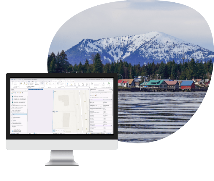
With all electric, water, and sewer assets mapped into ArcGIS Solutions, Petersburg now has accurate, up-to-date utility information. Crews in the field can quickly find and update asset details—even when snow or weather conditions make infrastructure harder to locate—while office staff see those changes instantly.
The impact is faster response when issues arise, better coordination between teams, and the ability to plan maintenance more efficiently. For the community, that means quicker repairs, fewer outages, and the confidence that essential services will keep running smoothly in every season.

What's Next
Scaling momentum across the organization
With Petersburg’s first complete utility system in place, the Borough now has a solid foundation to expand on. The centralized inventory paves the way for planned enhancements like integrating maintenance and work order management, which will automate how tasks are organized and scheduled.
Longer term, Petersburg can move to Esri’s Utility Network, which offers advanced modeling and analysis. This will make it easier for staff to trace issues, test scenarios, and prioritize future investments.




Case Study FAQ
A small utility organization can do this by turning legacy maps, CAD files, and staff knowledge into one centralized digital utility record that crews can actually use in the field and office. The goal is to digitize old information and to preserve what experienced staff know before that knowledge is lost. This makes knowledge accessible to everyone who needs it.
That matters because utilities often rely on a mix of paper maps, memory, and disconnected files to locate infrastructure and plan work. Over time, that creates risks. Records become harder to trust, newer staff have less context, and routine maintenance or emergency response can slow down because the right information is not easy to find. A centralized GIS can convert scattered knowledge into an operational system that lasts beyond individual employees.
In Resource Data’s case study, Petersburg Borough relied on outdated paper maps and CAD files, some of which were missing key spatial data or showed incorrect asset locations. Resource Data and Borough staff recovered usable legacy information, corrected records, and mapped thousands of utility assets into a complete digital system. This Resource Data case study shows that digitizing utility knowledge can reduce operational uncertainty, improve continuity, and give a small community a more reliable foundation for long-term infrastructure management.
Outdated utility maps create bigger problems in remote communities because field conditions, distance, and limited staffing leave less room for trial and error. When infrastructure is hard to reach and crews cannot quickly confirm what is underground or where a buried asset is located, delays become more costly and service risk becomes harder to manage.
In remote places, the environment itself adds to potential issues. Snow, gravel roads, buried infrastructure, and limited access can make manholes, valves, and other assets difficult to find even under normal conditions. If the records are incomplete or incorrect, staff may have to rely on memory or guesswork at the exact moment they need dependable information. That can slow repairs, increase labor costs, and make routine work less efficient.
In Resource Data’s case study, Petersburg’s location and climate made inaccurate utility records a real problem. Snow and gravel roads often hid buried assets, and with only one staff member experienced in GIS, the Borough had limited capacity to correct records or modernize systems on its own. This case study demonstrates that accurate digital utility records are especially valuable in remote service environments. The business and operational impact is faster field response; lower risk of avoidable delays; and better continuity for essential electric, water, and sewer services.
A municipality can expect faster response times, more efficient maintenance planning, and more reliable service when crews can locate utility infrastructure quickly year-round. When field teams know exactly where assets are and can confirm details without wasting time on searching, routine work and urgent response become more predictable and effective.
This improvement is especially important for electric, water, and sewer operations because many service disruptions become more difficult and expensive when crews can’t locate the right valve, hydrant, transformer, or manhole immediately. Better location data helps reduce downtime, improve coordination between field and office staff, and support more confident decision-making during repairs and maintenance.
Resource Data’s case study illustrates how Petersburg crews can now find and update utility asset details quickly, even when snow or weather conditions make infrastructure harder to locate. Plus, office staff see those updates right away. The result is faster response when issues arise, better coordination between teams, and more efficient maintenance planning. This case study demonstrates that better utility records improve mapping and service delivery. They also reduce avoidable delays and help the community experience quicker repairs and fewer outages.
A utility modernization project can improve reliability without the cost of custom software by using proven, prebuilt platforms and then tailoring them to the agency’s specific needs. This approach gives the organization a faster starting point, lowers implementation risk, and avoids the expense of creating an entirely new system for common utility management functions.
For many local governments, the challenge is not that they need a unique platform. They need a dependable system that reflects their assets, workflows, and field realities. A configurable off-the-shelf foundation often delivers that more efficiently than a fully custom build, especially when paired with field data collection and local process knowledge.
In Resource Data’s case study, Petersburg Borough’s first complete digital utility system was built on three prebuilt Esri ArcGIS Solutions and ArcGIS Online, then customized with the fields local crews rely on, such as equipment type, make, and installation date. This case study shows how local governments can modernize utility operations affordably by combining ready-made tools with practical configuration and data improvement. The business and operational impact is faster deployment, lower cost than starting from scratch, and a more reliable system that staff can use immediately.
Creating one trusted utility record is important because long-term maintenance planning depends on knowing what assets exist, where they are, and what condition or history is associated with them. Without that shared record, maintenance decisions are harder to prioritize. Also, field work is less predictable, and future investment planning becomes more reactive than strategic.
A trusted record also improves organizational coordination. If field crews, office staff, and leadership are working from the same, current information, it becomes easier to spot trends, plan replacements, organize work, and justify future improvements. That is especially important for smaller utilities that need to make careful use of limited budgets and staff time.
In Resource Data’s case study, legacy maps and files were combined into a corrected ArcGIS Online system, and each asset was tagged by source so staff could see whether information came from high-accuracy GPS collection or older records. The resulting centralized inventory gives Petersburg Borough a reliable foundation for future maintenance integration, work order management, and, eventually, Utility Network adoption. This case study demonstrates that one trusted utility record supports better planning, smarter prioritization, and stronger long-term infrastructure management. The operational impact is less uncertainty, better capital planning support, and more effective use of staff and budget.
It takes a combination of standardized utility data models, careful review of legacy records, and intensive field verification to build a trustworthy digital utility system from incomplete source materials. Converting paper maps and CAD files is usually not enough. The organization also has to validate what is still accurate, remove what is outdated, and fill in missing information through field collection.
That process works best when the utility system is built on a structured data foundation rather than an ad hoc map. Standardized data models help organize electric, water, and sewer assets consistently, while field collection confirms locations and attributes that legacy records may not capture accurately. This creates a system that is usable for viewing data and maintaining it over time.
In Resource Data’s case study, the Borough’s first complete digital utility system was built using three prebuilt Esri ArcGIS Solutions for electric, water, and sewer data management. Historic paper maps, aerial imagery, and AutoCAD files were reviewed and corrected, outdated entries were removed, and more than 37,000 features were mapped. The case study shows that building a reliable digital utility system requires structured software foundations and rigorous data cleanup. The business and operational impact is a more maintainable utility dataset, improved field confidence, and a stronger base for future system expansion.
Standardized ArcGIS utility data models help small utilities move faster because they provide a ready-made framework for common utility assets, workflows, maps, and dashboards without requiring the organization to design every layer and field from scratch. That shortens implementation time and reduces the complexity of building a usable system.
For smaller utilities, this matters because staff capacity is often limited, and modernization projects need to produce value quickly. Starting from an industry-standard model also makes it easier to organize electric, water, and sewer data in a consistent way that supports future enhancements. The system can still be tailored to local needs, but the organization avoids reinventing the basics.
In this case study, Resource Data’s team deployed three Esri ArcGIS Solutions as the foundation for Petersburg Borough’s new system: Electric Distribution Data Management, Water Distribution Data Management, and Sewer Data Management. Those solutions provided standardized data models, dashboards, and web maps. Those were then customized so field crews could rely on them locally. This case study example shows that prebuilt utility GIS models can accelerate modernization while still allowing local configuration. The operational impact is faster deployment, lower implementation overhead, and a system built on proven utility management patterns.
Mobile GIS tools and GNSS receivers play a central role because they allow crews to collect asset locations and details directly in the field with much better precision than legacy maps or memory-based methods can provide. That field accuracy is critical when utilities need to locate buried or hard-to-see infrastructure quickly and reliably.
Mobile tools also improve data quality by guiding crews through the information they need to collect at the time they are standing at the asset. Instead of writing notes separately and updating records later, staff can capture coordinates, attributes, and observations in one workflow. This reduces transcription errors and helps make the resulting dataset more complete.
In Resource Data’s case study, Resource Data and Borough staff used ArcGIS Field Maps on iPads paired with Bad Elf GNSS receivers to map thousands of utility assets and pinpoint them within a few meters. The mobile workflow captured location and attribute information for assets such as transformers, fire hydrants, and manholes. This work shows that field-ready GIS tools are essential for turning utility inventories into operationally reliable systems. Petersburg Brough’s business and operations benefited from better location accuracy, less field guesswork, and faster service response.
Real-time syncing improves utility operations by making sure everyone is working with the same, current information instead of waiting for paper notes or delayed updates to move back to the office. When field changes appear immediately in the central system, staff can respond faster, avoid duplicated effort, and make better decisions based on the latest asset information.
This matters because utility work often depends on close coordination between people in the field and people managing records, scheduling work, or monitoring system conditions from the office. If updates are delayed, an organization can end up planning work with outdated information or repeating tasks that have already been completed. Real-time sync reduces that friction.
In Resource Data’s case study, changes made in the field sync automatically into the system so office staff can see them right away. The case study shows how this leads to quicker decisions and helps avoid duplicated effort. This example also demonstrates that real-time data synchronization turns GIS from a static record into a live operational tool. The business and operational results included better coordination, faster decision-making, and a more efficient workflow across crews and office teams.
A centralized GIS utility inventory prepares a municipality for future capabilities by creating the clean, structured asset data those next-stage systems depend on. Work order integration, advanced tracing, scenario testing, and Utility Network adoption require a consistent and trustworthy asset record. Without that foundation, future modernization efforts become harder, slower, and more expensive.
This is why first-generation digital utility projects matter so much. They are not only about solving today’s visibility problem. They are also valuable to prepare the organization for more advanced forms of infrastructure management later. Once the underlying data is standardized and centralized, it becomes much easier to connect GIS with maintenance tools or move into more advanced modeling.
In Resource Data’s case study, Petersburg’s centralized inventory lays out the groundwork for integrating maintenance and work order management, and the Borough is positioned to move to Esri’s Utility Network in the future for advanced modeling and analysis. This case is a good example of how foundational GIS modernization is a platform decision, not just a recordkeeping improvement. The Borough gained stronger readiness for automation, better long-term planning, and a clearer path toward more advanced utility management capabilities.