




Hands-On GIS Modernization Builds Lasting Confidence

In Brief
Guided upgrade transforms enterprise capabilities
When Ada County Highway District’s (ACHD) aging ArcGIS Enterprise system began limiting functionality, the organization seized the chance to modernize.
Partnering with Resource Data for structured planning and over-the-shoulder coaching, ACHD deployed a fresh Enterprise environment and eliminated technical debt in the process. With renewed confidence and capability, ACHD now manages a secure, scalable GIS platform that powers daily operations across Idaho’s most populated county.
Key Takeaways
Empowered GIS Team. Sustainable System Management.
-
Independence through guided coaching
ACHD staff led their own deployment with Resource Data’s coaching, gaining the skills and confidence to deploy future updates without outside help.
-
A fresh start for better performance
A new version of ArcGIS Enterprise replaced the legacy software, giving the District a faster, and easier-to-maintain system.
-
Available tools to strengthen system management
With the latest ArcGIS Enterprise software in place, ACHD can take advantage of advanced models for roads, utilities, and stormwater data to strengthen planning, inspections, and long-term asset management.
-
Reusable playbook ensures lasting success
Project documentation, session recordings, and lessons learned give ACHD a reference toolkit to replicate deployments and maintain consistency as their GIS evolves.
Our Client
Ada County Highway District
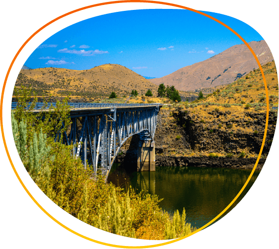
The Ada County Highway District (ACHD), the only countywide highway district in Idaho, is responsible for planning, constructing, maintaining, and improving all local streets and infrastructure within Ada County, excluding state highways. In fulfilling this role, ACHD oversees more than 4,800 lane-miles of roads and nearly 800 bridges across the state’s most populous county.
Challenges
Aging environment threatened performance and protection
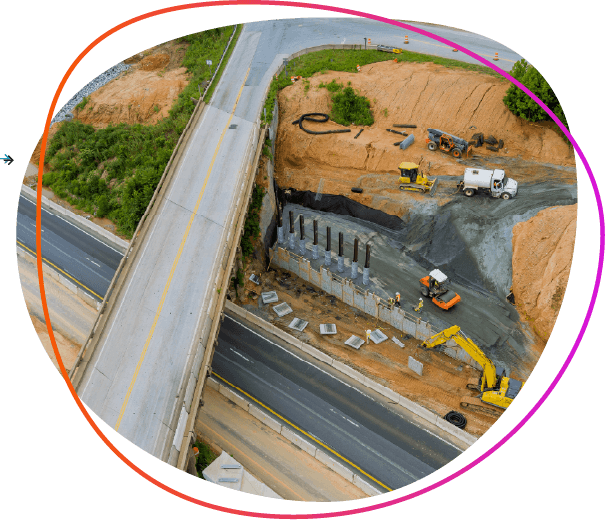
Ada County Highway District’s enterprise GIS was several versions behind the current release and approaching end of support. The older environment was cluttered with unused content and no longer followed best practices for performance.
Remaining on this platform meant growing technical debt, slower workflows, and limited access to new capabilities. It also increased the risk of system issues that would be harder to fix over time.
For an organization that depends on accurate, real-time data to manage roads, traffic, and infrastructure, these gaps threatened both internal efficiency and the District’s ability to keep employees and residents informed.
Approach
Step-by-step support with staff in the lead
ACHD’s goal was not just to stand up a new GIS environment but to be able to maintain and upgrade it themselves going forward. To support that, Resource Data designed a structured process that began by aligning ACHD’s GIS and IT teams through joint discovery sessions. This ensured both teams understood the system architecture, security requirements, and infrastructure needs.
Detailed pre-requisite checklists and an implementation plan gave the staff a clear roadmap, making it easier for them to take the lead during deployment. IT focused on provisioning servers, managing certificates, and setting network access controls, while GIS concentrated on deployment and data requirements.
During implementation, GIS staff completed the deployment themselves by sharing screens while Resource Data provided live step-by-step coaching. This process gave ACHD’s team practical experience and prepared them to manage the system independently.

The Solution
Secure, modern architecture to build on
ACHD chose to move away from its outdated environment and start fresh with ArcGIS Enterprise 11.5. They decided to recreate and migrate content from their older ecosystem as a fresh start. This decision avoided the clutter of the old system and gave their team a clean foundation for new data, services, and applications.
The deployment included Portal for ArcGIS, ArcGIS Server, Data Store, and Image Server, supported by Web Adaptors for seamless connectivity. The District’s IT group provided certificates, domains, and authentication enabling secure Single Sign-On integration. SSL certificates were applied across all components to ensure encrypted connections and compliance with security best practices.
Together, these elements created a modern enterprise GIS environment that supports advanced capabilities such as multi-user editing, parcel fabric, and utility networks. ACHD now has a secure, scalable foundation to run daily operations and publish public-facing mapping services with confidence.



Partnering with Resource Data streamlined the implementation of our new Enterprise GIS, making the process easier, more efficient, and repeatable. Their guidance has equipped ACHD with the knowledge and skills to sustain our system well into the future.
- Bob Wheeler, Geographic Information Systems Analyst, ACHD

Results
Confidence and control for ACHD’s team
ACHD now operates a secure, modern GIS environment managed entirely by its own staff. The guided, hands-on deployment gave the GIS team the practical experience to manage and maintain their system independently. The project also produced a reusable playbook comprised of documentation, session recordings, and lessons learned, ensuring repeatable processes and consistent standards.
The ACHD team has already used their new skills and documentation to successfully stand up development and staging environments. With a solid technical foundation and full control of their environment, ACHD can continue to sustain, expand, and evolve its enterprise GIS with confidence.
What's Next
Expanding GIS possibilities
ACHD’s enterprise GIS is built to evolve with their needs. The new environment gives them room to add datasets, build specialized applications, and integrate advanced models over time. As their operations and community expectations grow, ACHD is well-positioned to expand applications and services.




Case Study FAQ
A public-sector organization can do this by treating modernization as both a technology project and a staff capability project. If the internal staff participates directly in planning, deployment, and documentation, the organization gains more than a new system. It gains the ability to maintain and improve that system independently.
That matters because many upgrade projects solve the immediate technical issue but leave the organization dependent on external specialists afterward. A more sustainable model provides staff with practical experience during the implementation itself, along with clear documentation and repeatable processes they can use later. This builds internal confidence and reduces the risk that the new environment becomes difficult to manage once the project ends.
In Resource Data’s case study, the Ada County Highway District wanted to modernize its enterprise GIS and maintain and upgrade it independently going forward. Resource Data supported that goal with structured planning and over-the-shoulder coaching while ACHD staff led the deployment work. This Resource Data case study demonstrates that a guided modernization approach can reduce dependence on consultants, strengthen internal ownership, and create a more sustainable long-term operating model.
Aging GIS environments create operational risk because they become harder to maintain, harder to support, and less able to keep up with the data and service demands an agency faces every day. For agencies responsible for critical infrastructure, GIS is a core operational system. It supports planning, maintenance, communication, and decision-making across critical operations.
As systems get older and fall behind current releases, they often accumulate technical debt, unused content, and outdated practices that slow down staff and make problems harder to fix. That can affect both internal efficiency and the agency’s ability to provide reliable information to employees and the public. Over time, the risk grows because support options narrow and recovery from system issues becomes more difficult.
In Resource Data’s case study, ACHD’s enterprise GIS was several versions behind and approaching the end of support. The environment no longer followed best practices for performance and was cluttered with unused content. This Resource Data case study demonstrates that delaying modernization increases operational risk, while modernizing earlier improves reliability, reduces support challenges, and strengthens day-to-day performance.
Agency leaders should look for a modernization approach that intentionally builds staff capability during the project, not just after it. A successful project leaves behind more than upgraded software. It leaves behind a team that understands how the environment works, how to maintain it, and how to repeat key processes in the future.
That usually means choosing a partner and project structure that includes joint planning, clear implementation steps, direct staff participation, and durable reference materials. If the internal team only sees the finished product, confidence often remains low. If the team helps perform the work with expert guidance, confidence grows because experience and ownership are built into the process.
In Resource Data’s case study, ACHD staff completed the deployment themselves with live coaching from Resource Data, and the project produced documentation, session recordings, and lessons learned that the team could use later. ACHD then used those skills to stand up development and staging environments on its own. This Resource Data case study demonstrates that lasting staff confidence comes from guided ownership, hands-on experience, and repeatable documentation, resulting in lower support dependence, and a more resilient GIS program.
A GIS modernization project improves long-term planning and service delivery by giving the agency a more dependable platform for managing infrastructure data, supporting operational workflows, and expanding future mapping and asset management capabilities. For a highway district or transportation agency, GIS affects how teams understand roads, bridges, utilities, inspections, and public-facing information, so improvements to the platform can have wide operational value.
A stronger GIS environment helps the agency use data more consistently and with greater confidence. It also makes it easier to add new datasets, build specialized applications, and support more advanced planning models over time. The value is not just technical cleanliness. It is better to support how the organization manages assets and serves the public.
In Resource Data’s case study, ACHD’s new environment positioned the District to take advantage of advanced models for roads, utilities, and stormwater data, as well as new services and applications over time. This Resource Data case study demonstrates that GIS modernization supports better long-term planning, stronger operational decision-making, and a more scalable foundation for public infrastructure management. The business and operational impact is improved efficiency, better asset visibility, and stronger readiness for future growth.
A reusable deployment playbook is valuable because it turns a one-time upgrade into a repeatable internal capability. Without a playbook, much of the project’s knowledge can remain informal or tied to specific individuals. With one, the organization has a practical reference for repeating deployments, maintaining standards, and training staff more consistently over time.
This matters because the real test of a modernization project often comes after the initial rollout. Teams need to build additional environments, troubleshoot issues, apply updates, and maintain consistency as the GIS program evolves. Documentation, session recordings, and lessons learned help reduce relearning and make the organization less vulnerable to staff turnover or loss of institutional memory.
In Resource Data’s case study, the project produced a reusable playbook comprising documentation, session recordings, and lessons learned. ACHD later used those materials to successfully stand up development and staging environments. This Resource Data case study demonstrates that a playbook is not just project documentation. It is a sustainability tool that supports repeatability, continuity, and stronger internal system management. The operational impact is more consistent with execution, lower reliance on outside support, and better long-term control of the GIS environment.
It takes a combination of sound technical architecture, coordinated planning, and staff participation in the deployment process. Replacing an outdated ArcGIS Enterprise environment requires more than installing new software. The organization has to decide how to structure the new environment, to properly prepare the infrastructure, and ensure staff understand how the system is built so they can manage it later.
A strong modernization effort usually includes defining the target architecture, validating prerequisites, assigning responsibilities between GIS and IT, and documenting the deployment process clearly enough for staff to follow and repeat it. If internal teams are expected to sustain the system, they need hands-on familiarity with the components and how they work together.
In Resource Data’s case study, ACHD moved to a fresh ArcGIS Enterprise 11.5 environment with Portal for ArcGIS, ArcGIS Server, Data Store, Image Server, and Web Adaptors. Resource Data supported the District with structured planning and live coaching while ACHD staff led the deployment. This Resource Data case study demonstrates that a manageable enterprise GIS environment depends on both technical design and skill transfer. The impact is a more secure, scalable platform and a team that can operate it with confidence.
GIS and IT teams can coordinate effectively by establishing a shared implementation plan early and assigning responsibilities based on each team’s expertise. ArcGIS Enterprise upgrades span infrastructure, security, network access, certificates, authentication, and application-specific deployment, making clear ownership essential.
The most effective model is one where both teams understand the target architecture and how their tasks connect. IT usually handles server provisioning, certificates, access controls, and authentication, while GIS focuses on deployment of sequencing, data requirements, and service needs. When that division of labor is set up front, teams can move faster and avoid late-stage blockers.
In Resource Data’s case study, Resource Data aligned ACHD’s GIS and IT teams through joint discovery sessions before implementation began. IT focused on provisioning servers, managing certificates, and controlling network access, while GIS focused on deployment and data requirements. This Resource Data case study demonstrates that clear cross-team coordination reduces implementation friction, improves security readiness, and creates a smoother path through enterprise GIS modernization.
Starting fresh can provide cleaner architecture, better performance, and easier long-term maintenance when the legacy environment contains too much outdated content or accumulated technical debt. An in-place upgrade may preserve old problems along with old content, while a fresh deployment gives the team a chance to rebuild around current best practices.
A fresh deployment is particularly valuable when the existing environment has accumulated significant technical debt or unused content. A clean environment allows the organization to be more selective about what it migrates, and how new data, services, and applications are organized. That creates a more stable technical baseline for future growth.
In Resource Data’s case study, ACHD chose to recreate and migrate content from its older environment rather than carry everything forward as-is. That decision gave the District a clean foundation and avoided bringing legacy clutter into the new system. This Resource Data case study demonstrates that a fresh deployment can improve technical clarity, reduce maintenance burden, and create a more stable environment for future GIS operations.
They play a central role in making the environment secure, usable, and aligned with government security expectations. A modern ArcGIS Enterprise deployment requires more than functional components. It needs controlled access, trusted authentication, and encrypted communication across the environment to support both internal users and public-facing services responsibly.
These measures improve operational confidence, protecting sensitive access paths, and support broader IT governance standards. They also make it easier for staff to use the system consistently by relying on familiar authentication processes, rather than on fragmented or weaker access methods.
In Resource Data’s case study, ACHD’s IT team provided certificates, domains, and authentication, enabling secure Single Sign-On integration, and SSL certificates were applied across all components to ensure encrypted connections. This Resource Data case study demonstrates that security controls are a foundational part of enterprise GIS modernization. The operational impact is security risk reduced, better access management, and stronger confidence in the platform’s long-term reliability.
Hands-on deployment experience helps by giving the GIS team a practical understanding of how the environment is assembled, configured, and maintained across different stages. That kind of experience is much more useful than theoretical knowledge alone when staff need to repeat the process later for development, staging, or future production updates.
Once a team has worked through deployment steps, it is better prepared to troubleshoot issues, consistently follow standards, and stand up additional environments without starting from scratch. This reduces dependence on outside support and helps the organization maintain technical consistency across environments.
In Resource Data’s case study, ACHD staff completed the deployment themselves with live coaching from Resource Data and later used their new skills and documentation to successfully stand up development and staging environments. This Resource Data case study demonstrates that hands-on experience strengthens technical self-sufficiency and makes future environment management more repeatable. The business and operational impact is better internal capability, faster future deployments, and more consistent system administration over time.